INTRODUCING
BOOKINGS ON WIKICAMPS
Otaika Valley Walkway
 Outdoor Recreation Area
Description
The Otaika Valley Walk offers you a variety of landscapes including farmland and native forest.
2.5 km to reserve boundary, 4.5 km to Raumanga
2-3 hr one way
Easy: Walking track
It is recommended that you start this walk from the sign-posted car park on Otaika Valley Road.
The track rises up steeply from the Otaika Valley stream. Once on the ridge, there are good viewing areas offering expansive views of Maungatapere and northwest Northland. There is also a seat along the ridgeline (264 metres above sea level) that gives fantastic rural views of Otaika Valley.
The track drops off the ridgeline and crosses over several small streams. Vegetation in this area is mostly regenrating kauri, tanekaha, and totara.
The reserve finishes at the kissing gate. Here you can return the way you came or continue on across open pasture, following the orange posts, until you reach Raumanga Heights Drive.
10,000 Steps Northland: This track equates to approximately 7,998 steps.
A good alternative is to walk from Otaika Valley to the northern boundary of the scenic reserve and then return to the car park. The distance by road from the start of the track to the end is 4.8 km. You can walk back via the road or use two cars.
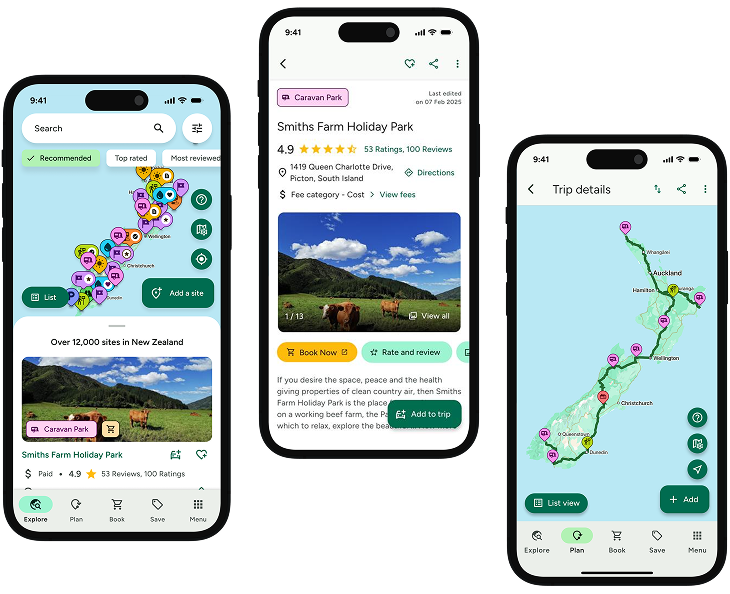
Find this site and more on WikiCamps
Take the ultimate camping companion on your next trip, with these great features:
![]() Explore more than 60,000 sites across New Zealand with detailed site information at your fingertips
Explore more than 60,000 sites across New Zealand with detailed site information at your fingertips
![]() Stay in the know with exclusive, insightful reviews from fellow travellers
Stay in the know with exclusive, insightful reviews from fellow travellers
![]() Map journeys, plan your route, and gauge your fuel spend with Trip Planner
Map journeys, plan your route, and gauge your fuel spend with Trip Planner
![]() No signal? No worries! Use offline mode to travel anywhere with WikiCamps
No signal? No worries! Use offline mode to travel anywhere with WikiCamps
![]() Add sites to your collections, search with intuitive filters, and so much more...
Add sites to your collections, search with intuitive filters, and so much more...
Get WikiCamps now!
Download WikiCamps from the App Store on your device.

