INTRODUCING
BOOKINGS ON WIKICAMPS
Radar Hill Viewpoint
 Point of Interest
Description
Radar Hill is the highest point on Wainui Road and is found midway between Wainui Bay and Tauranga Bay. It so named because it was the site of a Royal New Zealand Air Force radar station, established in 1942 to monitor air and coastal traffic as part of New Zealand's defence efforts during World War 2.
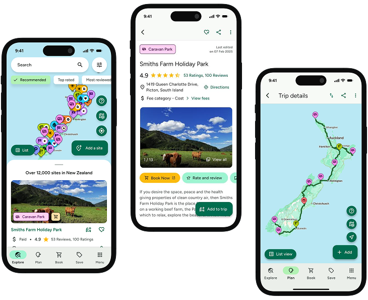
Find this site and more on WikiCamps
Take the ultimate camping companion on your next trip, with these great features:
![]() Explore more than 60,000 sites across New Zealand with detailed site information at your fingertips
Explore more than 60,000 sites across New Zealand with detailed site information at your fingertips
![]() Stay in the know with exclusive, insightful reviews from fellow travellers
Stay in the know with exclusive, insightful reviews from fellow travellers
![]() Map journeys, plan your route, and gauge your fuel spend with Trip Planner
Map journeys, plan your route, and gauge your fuel spend with Trip Planner
![]() No signal? No worries! Use offline mode to travel anywhere with WikiCamps
No signal? No worries! Use offline mode to travel anywhere with WikiCamps
![]() Add sites to your collections, search with intuitive filters, and so much more...
Add sites to your collections, search with intuitive filters, and so much more...
Get WikiCamps now!
Download WikiCamps from the App Store on your device.

