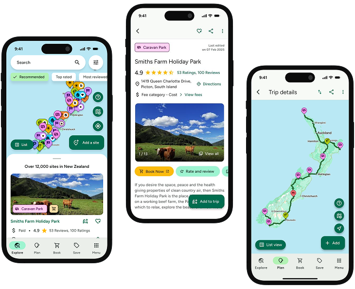
INTRODUCING
BOOKINGS ON WIKICAMPS
Lake Kaniere Walkway 1
 Outdoor Recreation Area
Description
Walk or mountain bike along the western shores of Lake Kaniere through lush lakeside forest, passing many picturesque bays and numerous forest streams.
Walking and tramping - 4 hr Easy: Walking track
Mountain biking - Intermediate: Grade 3 & Advanced: Grade 4
Starting (or ending) at the road end just past Sunny Bight picnic area, the Lake Kaniere Walkway is a four hour tramp around the western shore of Lake Kaniere. The walkway emerges at the southern end of the lake on the Dorothy Falls Road.
Highlights of the walk include many picturesque bays, numerous forest streams and lush lakeside forest. A lookout point over the lake is offered part way up Mt Upright/Te Taumata o Uekanaku.
There are numerous places to take a dip. Or when you have finished walking or riding Hans Bay is a popular local swimming spot.
The walk is suitable for people of average fitness and tramping boots are required.
Mountain biking
The track is a mixture of intermediate and advanced riding with a short section of expert, grade 5 track near the Dorothy Falls end.
Find this site and more on WikiCamps
Take the ultimate camping companion on your next trip, with these great features:
![]() Explore more than 60,000 sites across New Zealand with detailed site information at your fingertips
Explore more than 60,000 sites across New Zealand with detailed site information at your fingertips
![]() Stay in the know with exclusive, insightful reviews from fellow travellers
Stay in the know with exclusive, insightful reviews from fellow travellers
![]() Map journeys, plan your route, and gauge your fuel spend with Trip Planner
Map journeys, plan your route, and gauge your fuel spend with Trip Planner
![]() No signal? No worries! Use offline mode to travel anywhere with WikiCamps
No signal? No worries! Use offline mode to travel anywhere with WikiCamps
![]() Add sites to your collections, search with intuitive filters, and so much more...
Add sites to your collections, search with intuitive filters, and so much more...
Get WikiCamps now!
Download WikiCamps from the App Store on your device.

